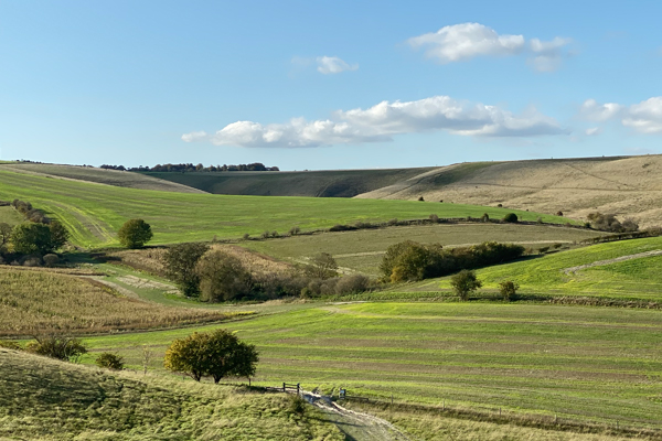
Letcombe Regis Walk
A lovely walk in the Vale of White Horse from the lovely little village of Letcombe Regis, through Letcombe Bassett and then up to the Ridgeway coming back via the ancient Segsbury iron age fort.
Walk Facts:
Distance: 8.3 km / 5.16 miles
Total Climb: 161m
Walked: Late October 2019
The route:
This walk starts from The Greyhound pub in Letcombe Regis.
Head south from the pub and pass the church to the left hand side towards the Richmond Villages shop. Follow the road to the right of the shop and you will find an alleyway. This takes you down to the Letcombe Brook. Cross the bridge and out onto the road.
Turn left (south) and then follow past recreation ground, a small burial-ground and follow the wall. Take the road on the left opposite the entrance to Blandys Farm. A short way along, the road becomes a footpath and crosses back over the Letcombe Brooke. Go through the gate and join the Letcombe Valley and a well-established pathway. It brings you out into a nature reserve, follow the grass pathway to the left (south east) not the gravel one to the right (south west).
At the top go through the gate and take the bridlewaypath to the right. You very quickly come to another gate with a footpath that actually leads off to the right just before it.
It’s a lovely walk along the top a little valley cut out by the Letcombe Brook. It brings you to the village of Letcombe Bassett,
Here you have a couple of options…
Letcombe Basset Option One
The most direct route is to turn in to Basset Road and then head west on to Holborn Hill until you get to a playground take a left turn out into the fields.
Letcombe Basset Option Two
An alternative longer, but I think prettier way is to turn left and go up Rectory Lane (basically continuing south). Pass the pretty cottages and under the wooden footbridge. The road turns to grass and then you’ll find a style at the top on the right.
Cross the field while stopping to enjoy the views of the beautiful thatched barn and across the valley. The path ducks back into the woods and comes quickly down onto a road, turn right (north) and return into the village.
Turn left after the old rectory and into Fosters Lane passing the tiny chapel.
At the end go through the kissing gate and take the pathway across the field to the right. Turn right at the side gate set on its own away from the fence and follow fence line north back down towards the village. Through gate, pass some farm buildings and out onto the road. Turn left follow the (Holborn Hill) road a little way and just after the playground take a left turn out into the fields.
This is a permissive path so make sure you stick to the route you or you might get shot!
You’ll see the pathway continues up the hill in the distance to the south east. It is well signposted. The path leads to a corner of fencing turn to the left and follow the fence line continuing uphill south east towards the hedge in the distance.
Once up to the corner of the fence line follow the little track around to the right and then all the way to the top. Don’t forget to stop and take in the views, especially of the Devils Punchbowl and Childrey Warren.
At the top you will find the Ridgeway and once again are on public rights of way. You are going to turn left (east) and follow this ancient path for quite a while (2.2km). Hopefully you have a nice clear day, because the views are absolutely stunning.
About 900m along you cross Gramps Hill, just keep going. The path can get very muddy at times, so be prepared to do some puddle jumping. Continue past Smith Hill which has a little carpark and a signpost back down to Letcome Bassett.
As you come to Segsbury Farm your time on the Ridgeway is over for this walk. Now take the road to the north. Here begins the descent back to the Letcombes.
First though the trackway cuts straight through the ancient Segsbury Fort. You can chose to follow the road, but you can also walk the old mound of the fort. Again this is a permissive pathway so make sure you follow all the instructions at the entrance to the fort.
Continue down the hill following the road all the way into the village it’s a steady descent on a hard road surface, so nothing too much to struggle about and not too much traffic either.
When you enter Letcombe Regis turn in to South Street which takes you back to the church and then the pub on Main Street. There is also a cut through way which heads between the houses from Anvil Lane, bringing you out at Post Office Lane.