
Brill and Oakley
Just over the Oxfordshire border, but surrounded by the county and with great views in to it, this walk starts at the top of the hill in Brill and loops down to Oakley and climbing back via the historic windmill.
Walk Facts:
Distance: 10.57km / 6.5 miles
Total Climb: 225m
Walked: April 2019
The route:
10.6 km, 02:57:03

Route description:
This route starts from The Pointer on Church Street. There is also a pub called The Pheasant which is on Windmill Street, you can follow the last few instructions to get to the start point from there. Head up to the church and walk along The Green. You will find the footpath begins to the right after a wide grassy stretch of the road and leads off south in to open fields and immediately you see some lovely views.
Keep Brill House to your right hand side and head into a larger field through the gate. The pathway then turns to the left through some pretty muddy churnings and some animal pens and continues in a straight line east eventually veering to the right and beginning a descent from the top of the hill.
Continue through a double set of gates (although one seems to be no longer be used) and continue across the fields with the distant Chiltern Park farm ahead and just to the right.
Go through the kissing gate. You can see the large Ardley incinerator off to the north in the distance. The footpath continues to the left hand side of the farm.
You'll find another kissing gate just after the farm buildings and then continue down the hill heading towards the copse of woodland directly ahead. The next gate is right in the middle of the trees.
Go through the copse, across the rickety bridge, back through another gate and then directly south-east across the next field. Cross over the rickety style through the hedge and then turn immediately right. Follow the hedge south-west, keeping it on your right.
The path opens up into the next field where continue in a straight line. If you can't see the path (there was no sign of it when I walked the route) use the two trees as markers. In the middle of the field turn to the right and look north-west. You should see a style at the end of the line of trees on the fields edge. If the field is overgrown you might actually want to retrace your steps and then follow the edge of the field to the next style. The path follows the side of the field north westerly.
Cross the trackway and then begin to climb again. Stay in a straight line heading pretty much north-west. It's then across the field, through the little gate and then in to the next field through the gap. If you are wondering where the footpath is, just head to that gap. Cross the next field aiming for the corner with Parkpale Farm in. Pick up the farm track and follow it to the road.
Turn left south west and walk along the Thame Road for a little way and you will see the footpath head off between some gardens on the right.
At the end of the footpath is a little bench and a style - cross it into the field. Continue west across the field and go through the large gate and then turn left following the side of the field downhill towards Leatherslade Farm.
About halfway down the pathway go through the gates and it continues in a thin long stretch of woodland. It’s pretty overgrown in places and there are plenty of nettles, so long trousers are probably wise. It’s also really churned up in places so expect either to get muddy or possibly a twisted ankle!
Once you have circumnavigated Leatherslade Farm (which is where the Great Train robbers of 1963 hid out) join the farm track continuing downhill looking for a footpath off to the right. Go through the kissing gate and then head west across three fields in the direction of Little London.
The gate out of the final field and in to the village is about a third of the way from the left hand side along the far hedge. Cross the road onto the footpath and turn right looking for a footpath off to the left. You’ll find it by the postbox. The path is down a long little lane and a little unmade road. Pass beyond the last house (called Blackfriars) and the footpath continues - in fact its a bridleway.
Just after you pass under a significant low hanging branch the footpath peels off to the left hand side. You can either follow that or stick with the bridleway as they both join up a little further along. I chose to go along the footpath as it seems a lot less churned up - although it did have a pretty impressive style to get over!
The footpath crosses a style and returns to the bridleway, take it left (west). If you stick with the bridleway also keep to the left with it. Don’t be tempted to head right or east towards Nashway farm.
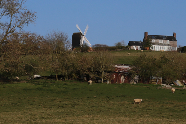
At the crossroads you’ll find lots of options. turn right and then immediately right there is a style where the footpath picks up again (the bridleway runs parallel but really you want to be on the footpath.) You can see up the hill to Brill and it’s windmill. We are headed back that way in the end!
The footpath continues in the field following the hedge to the left basically heading north then Northwest. Just after where the bridleway turns left the footpath also turns left across a style into the field heading north west.
At the corner of the next field your find a very rundown style which is pretty broken, so take care crossing it into a little patch of woodland. Vier to the right and find the Span Green track. Follow this and it’s rutted muddy road as far as the hamlet of Touchbridge.
Here Span Green joins the road heading north east. A short way along you will see a pathway split off to the right (after a farm track). This is the Bernwood Jubilee Way and we are going to follow it back to Brill. It passes through a kissing gate then some shrubland with nice views up to the Windmill, past some burnt out remains of something and across some fields.
Where you see the style is abandoned in the middle of nowhere about halfway along the hedge, cross into that field and then keep that hedge to the right and find the style out of the field.
You are now back in Brill.
Turn left to see the Windmill and to get to The Pheasant pub. To get back to the church follow Bernwood Jubilee Way to the right and then it turns North West again to bring you up to the village centre.
It’s just a short walk further to the church.
My Flickr photos from the route.
Route planned by Kate Brown and walked by Phil Mercer-Kelly.